Google Mapsライクな UI を提供するオープンソース JavaScript ライブラリの代表格である「OpenLayers」の最新版が完成しました。
詳細についてはこちらが詳しいですが、http://trac.openlayers.org/wiki/Release/2.8/Notes
新しいレイヤタイプとして OpenStreetMap や ArcXML が対応し、Google Maps や VirtualEarth 以外の情報もより取り込みやすくなりました。
木曜日, 6月 25, 2009
火曜日, 6月 23, 2009
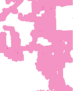
テヘランの衛星画像
イランの大統領選に関連したデモのニュースが連日報道されていますが、メールもチャットもTwitterも遮断されている状況で、Google Earth などのデジタルアースブラウザは、リアルとネットをつなぐ重要な位置づけとして具体的な結果を残しそうです。というのも、Google が50cm解像度を超えた最新鋭の高精細衛星GeoEyeの画像をGoogle Earthに投入する模様です。
ひとまずその第一弾がKMLとして提供されました。まだはっきりは見えませんが、パンシャープン処理や画像調整をすることで、より鮮明になるのではないでしょうか。

ひとまずその第一弾がKMLとして提供されました。まだはっきりは見えませんが、パンシャープン処理や画像調整をすることで、より鮮明になるのではないでしょうか。
金曜日, 6月 19, 2009
PostGISの新バージョン 1.4
PostGISの新バージョン 1.4にむけたベータ版がリリースされました。
http://postgis.refractions.net/documentation/manual-svn/
ダウンロードはこちらから
http://postgis.refractions.net/download/postgis-1.4.0b1.tar.gz
主な新機能は以下のとおりですが
AsGeoJSON() がいい感じ
Union処理など、かなりGISの解析処理まで領域が広がってきました。
http://blog.cleverelephant.ca/2009/01/must-faster-unions-in-postgis-14.html

Here are some more details about 1.4:
- API Stability
- As of the 1.4 release series, the public API of PostGIS will not
change during minor releases.
- Compatibility
- The versions below are the *minimum* requirements for PostGIS 1.4
- PostgreSQL 8.2 and higher on all platforms
- GEOS 3.0 and higher only
- PROJ4 4.5 and higher only
- New Features
- ST_Union() uses high-speed cascaded union when compiled against
GEOS 3.1+ (Paul Ramsey)
- ST_ContainsProperly() requires GEOS 3.1+
- ST_Intersects(), ST_Contains(), ST_Within() use high-speed cached
prepared geometry against GEOS 3.1+ (Paul Ramsey)
- Vastly improved documentation and reference manual
(Regina Obe & Kevin Neufeld)
- Figures and diagram examples in the reference manual (Kevin Neufeld)
- ST_IsValidReason() returns readable explanations for validity
failures (Paul Ramsey)
- ST_GeoHash() returns a geohash.org signature for geometries
(Paul Ramsey)
- GTK+ multi-platform GUI for shape file loading (Paul Ramsey)
- ST_LineCrossingDirection() returns crossing directions (Paul Ramsey)
- ST_LocateBetweenElevations() returns sub-string based on Z-ordinate.
(Paul Ramsey)
- Geometry parser returns explicit error message about location of
syntax errors (Mark Cave-Ayland)
- ST_AsGeoJSON() return JSON formatted geometry (Olivier Courtin)
- Populate_Geometry_Columns() -- automatically add records to
geometry_columns for TABLES and VIEWS (Kevin Neufeld)
- Enhancements
- Core geometry system moved into independent library, liblwgeom.
(Mark Cave-Ayland)
- New build system uses PostgreSQL "pgxs" build bootstrapper.
(Mark Cave-Ayland)
- Debugging framework formalized and simplified. (Mark Cave-Ayland)
- All build-time #defines generated at configure time and placed in
headers for easier cross-platform support (Mark Cave-Ayland)
- Logging framework formalized and simplified (Mark Cave-Ayland)
- Expanded and more stable support for CIRCULARSTRING,
COMPOUNDCURVE and CURVEPOLYGON, better parsing, wider support
in functions (Mark Leslie & Mark Cave-Ayland)
- Improved support for OpenSolaris builds (Paul Ramsey)
- Improved support for MSVC builds (Mateusz Loskot)
- Updated KML support (Olivier Courtin)
- Unit testing framework for liblwgeom (Paul Ramsey)
- New testing framework to comprehensively exercise every PostGIS
function (Regine Obe)
- Performance improvements to all geometry aggregate functions
(Paul Ramsey)
- Support for the upcoming PostgreSQL 8.4 (Mark Cave-Ayland, Talha Bin
Rizwan)
- Shp2pgsql and pgsql2shp re-worked to depend on the common
parsing/unparsing code in liblwgeom (Mark Cave-Ayland)
- Use of PDF DbLatex to build PDF docs and preliminary instructions
for build (Jean David Techer)
- Automated User documentation build (PDF and HTML) and
Developer Doxygen Documentation (Kevin Neufeld)
- Automated build of document images using ImageMagick
from WKT geometry text files (Kevin Neufeld)
- More attractive CSS for HTML documentation (Dane Springmeyer)
- Bug fixes
- http://trac.osgeo.org/postgis/query?status=closed&milestone=postgis+1.4.0&order=priority
http://postgis.refractions.net/documentation/manual-svn/
ダウンロードはこちらから
http://postgis.refractions.net/download/postgis-1.4.0b1.tar.gz
主な新機能は以下のとおりですが
AsGeoJSON() がいい感じ
Union処理など、かなりGISの解析処理まで領域が広がってきました。
http://blog.cleverelephant.ca/2009/01/must-faster-unions-in-postgis-14.html
Here are some more details about 1.4:
- API Stability
- As of the 1.4 release series, the public API of PostGIS will not
change during minor releases.
- Compatibility
- The versions below are the *minimum* requirements for PostGIS 1.4
- PostgreSQL 8.2 and higher on all platforms
- GEOS 3.0 and higher only
- PROJ4 4.5 and higher only
- New Features
- ST_Union() uses high-speed cascaded union when compiled against
GEOS 3.1+ (Paul Ramsey)
- ST_ContainsProperly() requires GEOS 3.1+
- ST_Intersects(), ST_Contains(), ST_Within() use high-speed cached
prepared geometry against GEOS 3.1+ (Paul Ramsey)
- Vastly improved documentation and reference manual
(Regina Obe & Kevin Neufeld)
- Figures and diagram examples in the reference manual (Kevin Neufeld)
- ST_IsValidReason() returns readable explanations for validity
failures (Paul Ramsey)
- ST_GeoHash() returns a geohash.org signature for geometries
(Paul Ramsey)
- GTK+ multi-platform GUI for shape file loading (Paul Ramsey)
- ST_LineCrossingDirection() returns crossing directions (Paul Ramsey)
- ST_LocateBetweenElevations() returns sub-string based on Z-ordinate.
(Paul Ramsey)
- Geometry parser returns explicit error message about location of
syntax errors (Mark Cave-Ayland)
- ST_AsGeoJSON() return JSON formatted geometry (Olivier Courtin)
- Populate_Geometry_Columns() -- automatically add records to
geometry_columns for TABLES and VIEWS (Kevin Neufeld)
- Enhancements
- Core geometry system moved into independent library, liblwgeom.
(Mark Cave-Ayland)
- New build system uses PostgreSQL "pgxs" build bootstrapper.
(Mark Cave-Ayland)
- Debugging framework formalized and simplified. (Mark Cave-Ayland)
- All build-time #defines generated at configure time and placed in
headers for easier cross-platform support (Mark Cave-Ayland)
- Logging framework formalized and simplified (Mark Cave-Ayland)
- Expanded and more stable support for CIRCULARSTRING,
COMPOUNDCURVE and CURVEPOLYGON, better parsing, wider support
in functions (Mark Leslie & Mark Cave-Ayland)
- Improved support for OpenSolaris builds (Paul Ramsey)
- Improved support for MSVC builds (Mateusz Loskot)
- Updated KML support (Olivier Courtin)
- Unit testing framework for liblwgeom (Paul Ramsey)
- New testing framework to comprehensively exercise every PostGIS
function (Regine Obe)
- Performance improvements to all geometry aggregate functions
(Paul Ramsey)
- Support for the upcoming PostgreSQL 8.4 (Mark Cave-Ayland, Talha Bin
Rizwan)
- Shp2pgsql and pgsql2shp re-worked to depend on the common
parsing/unparsing code in liblwgeom (Mark Cave-Ayland)
- Use of PDF DbLatex to build PDF docs and preliminary instructions
for build (Jean David Techer)
- Automated User documentation build (PDF and HTML) and
Developer Doxygen Documentation (Kevin Neufeld)
- Automated build of document images using ImageMagick
from WKT geometry text files (Kevin Neufeld)
- More attractive CSS for HTML documentation (Dane Springmeyer)
- Bug fixes
- http://trac.osgeo.org/postgis/query?status=closed&milestone=postgis+1.4.0&order=priority
登録:
投稿 (Atom)